
Fall Creek Falls

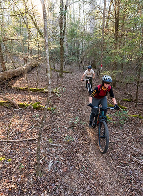
Fall Creek Falls State Park offers a scenic mountain biking experience in the heart of Tennessee’s Cumberland Plateau, surrounded by hardwood forests, rocky terrain, and beautiful natural features. The area is known for its rugged landscape, rolling hills, and elevation changes that can challenge riders while providing a rewarding backcountry feel. Riders can enjoy wooded trails and explore the park’s remarkable waterfalls, overlooks, and natural scenery. It’s a great destination for mountain bikers who want to combine outdoor adventure with the beauty of one of Tennessee’s most popular state parks.

Recommended Routes

Piney Creek
Distance: 1.4 miles (Green)
Elevation Gain: 161ft
Difficulty: Easy/Intermediate
Start/End: This trail can be accessed from Group Site Two
Beginning with a screaming steep downhill section on a double track jeep road, you’ll enjoy a picture-perfect row of pine trees that will lead you across Piney Creek. Here you will find campsites as well as the access to a narrow singletrack. This “Lower Loop” will circle you to the double track and back to the trail head. Make a multi-day bikepacking trip by linking this with the Upper loop trail.
Chinquapin Ridge Trail
Distance: 6 miles (Green)
Elevation Gain: 348 ft
Difficulty: Easy/Intermediate
Start/End: Newton Ford Picnic Area
This easy to navigate non-technical double track can be accessed from the Newton Ford Picnic area trailhead on highway 284 and directly connects to the Upper Loop making for an epic day ride. It is beginner friendly with slight elevation changes followed by short non-technical descents. Expect narrow streams crossings and a remote backcountry. Both fall and winter provide rewarding views from the high grounds.
Upper Loop Trail
Distance: 13 miles (Blue)
Elevation Gain: 2240 ft
Difficulty: Intermediate
Start/End: Newton Ford Picnic Area
A hidden gem, this back country trail traverses across the state park, WMA and TWRA managed land. The terrain varies from tight singletrack to double track with lots of rolling hills, rocky sections, and creek crossings. It is an ideal bikepacking route with designated camping areas with amenities on site. Some sections feel rugged and backcountry but park road 284 offers riders a quick exit if needed. Most creek crossings have bridges and crane pads but can also be crossed on foot. You won’t want to miss the newly installed suspension bridge over Cane Creek, which is a real treat to ride over. If you are looking for a big day in the saddle, connect to Chinquapin Ridge and Piney Creek for 35+ miles. Check with the park before riding as some sections are closed for hunting season.